Poplar is an interesting district. It has both Robin Hood Gardens (under threat of demolition) and Goldfinger’s Balfron Tower, sister to the Trellick Tower in North Kensington (and currently undergoing a deeply controversial renovation which will displace all of its existing residents, some of them permanently). Poplar also has the Blackwall Tunnel (Northern Approach), the A13 and the A1261. The last of those is euphemistically named ‘Aspen Way’: it is not scenic, nor tree-lined, consisting of six walled-off lanes of traffic, crossable on foot only by bridge or tunnel. The Blackwall Tunnel approach road becomes the six lane A102 and runs past Balfron Tower; this urban motorway was for Lynsey Hanley the most memorable aspect of living in Goldfinger’s building, as she did for a time in the 1990s. If you plot Poplar’s buildings on a figure-ground drawing you can see they form roughly rectilinear patches, with wide separations between the patches. Within each patch, the ground coverage (and often the density as well) is historically quite low. Take into account the separations and the density drops further.
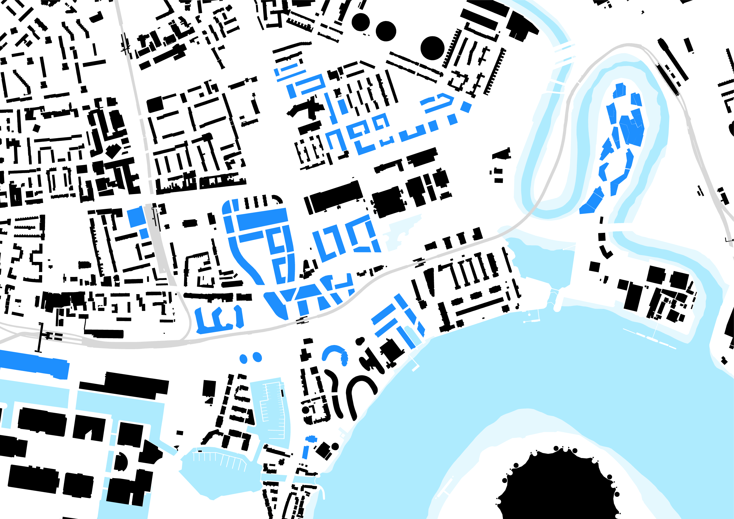
I’ve shown proposed development in blue: this is extensive, with perhaps the most ambitious plan being the redevelopment of the Leamouth peninsula. (The Millennium dome is at the lower right, and part of Canary Wharf is at lower left.) New development is mostly connected by the DLR (shown in grey): this is good. The wide separations, of course, are because of the roads, and they are monsters:

They slice the district into isolated pockets. New development, even if high quality, will not overcome this. The new construction tends towards very high spot density but integration remains poor. Where new development connects to the DLR – itself an elevated railway – a bubble existence becomes possible. This does have its own interest: the new East London is a city of big objects; heterogenous objects, connected by transit systems which are themselves multi-layered, and laid out in loops, as if the city here were a temporarily wired up, very large scale, Cedric Price style installation. And all viewed from above: the DLR itself gives one of the best views. The oddly located ‘Emirates Air Line’ cable car gives an even better view. It is not ‘good urban planning’. Canary Wharf gets a lot of the stick, but things started to go wrong (in the ‘good urban planning’ sense) in the 1960s, when the decision was made to make the Blackwall Tunnel into an arterial. That immediately problematised the Balfron Tower site (highlighted in yellow), Robin Hood Gardens to its south, and the Aberfeldy Estate to the east. I’m not sure what will fix it. Some people talk about brownfield development as the answer to Britain’s housing problem, but they usually forget about what goes alongside former industrial sites: big roads.

(Above: the Greenwich peninsula seen from the Leamouth peninsula development site.)
