One archetype of desirable urban life is found in the urban village. This conception of place in the city owes much to Jane Jacobs but is also seen in i.e. Abercrombie’s 1943 analysis of London’s neighbourhoods. The urban village typically has two faces: the high street face, and the ‘countryside’, or park face. I argue that both are fundamental. Ideally, both are found close together: they allow the village to be understood and enjoyed as a village. On the one side, shops, eateries, small business, primarily indoor social gathering spaces. On the other side, green open space, room for exercise and outdoor socialising, play, escape. In between: homes (and institutional support, i.e. schools). In the urban village, everything local of value is walkable.
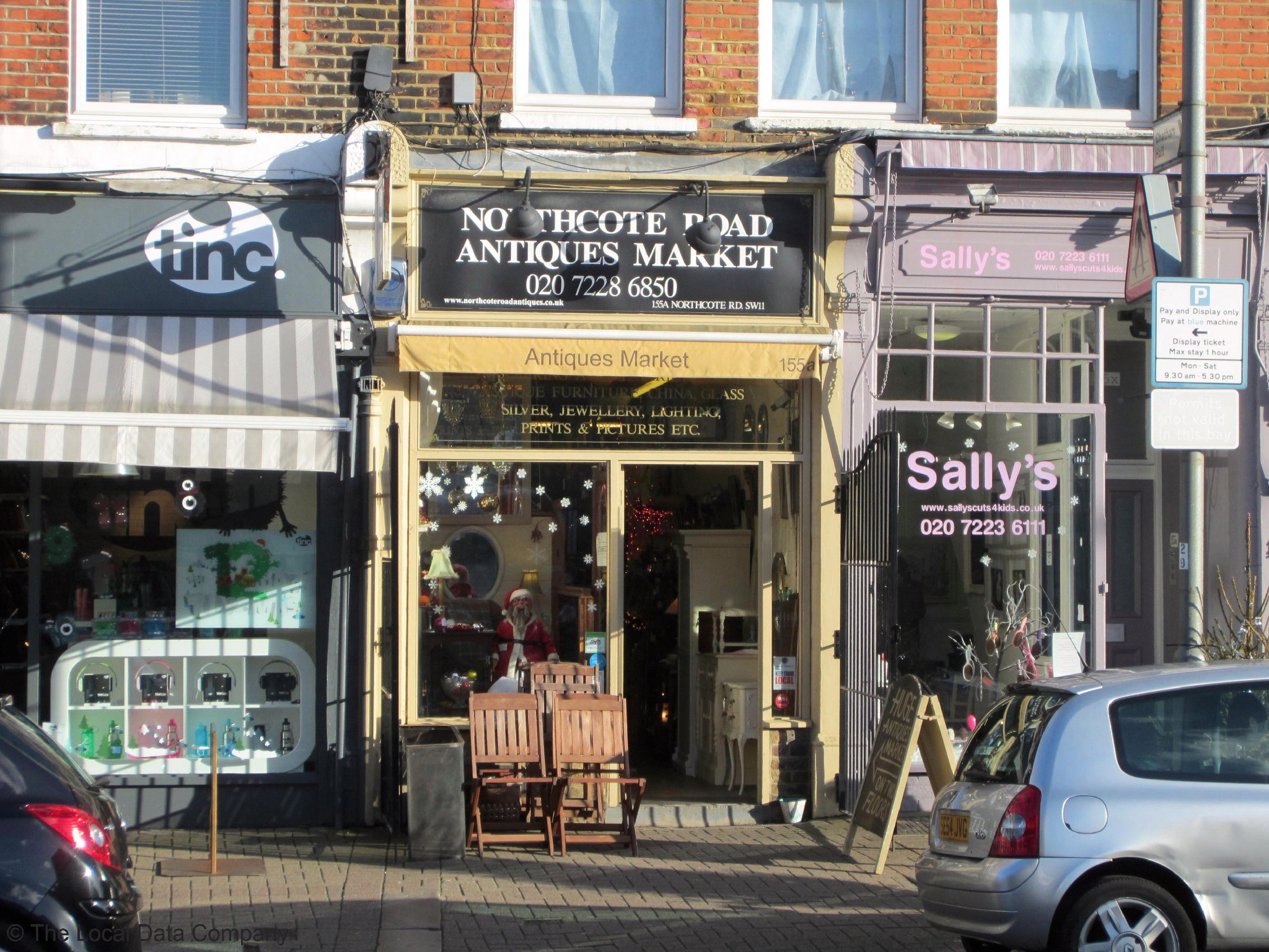
Northcote Road, Battersea, lies at the centre of an attractive and popular urban village. A quick look at the street layout of this neighbourhood shows that it closely tracks the model described above. Northcote Road itself is the high street. The countryside face of this village is – jointly – Wandsworth Common and Clapham Common, two decently sized urban parks. The perpendicular streets in between – Wakehurst Road for example – represent some of the most desirable streets in London for dwellings of this type and scale.

The block highlighted above is 270 m by 60 m; dimensions which – along with the simple grid topology – permit the walkability of the neighbourhood. In addition, Northcote Road, although narrow, carries buses for most of its length; it is a Connector that becomes a High Street (in Transport for London’s street hierarchy), with both movement and ‘place’.
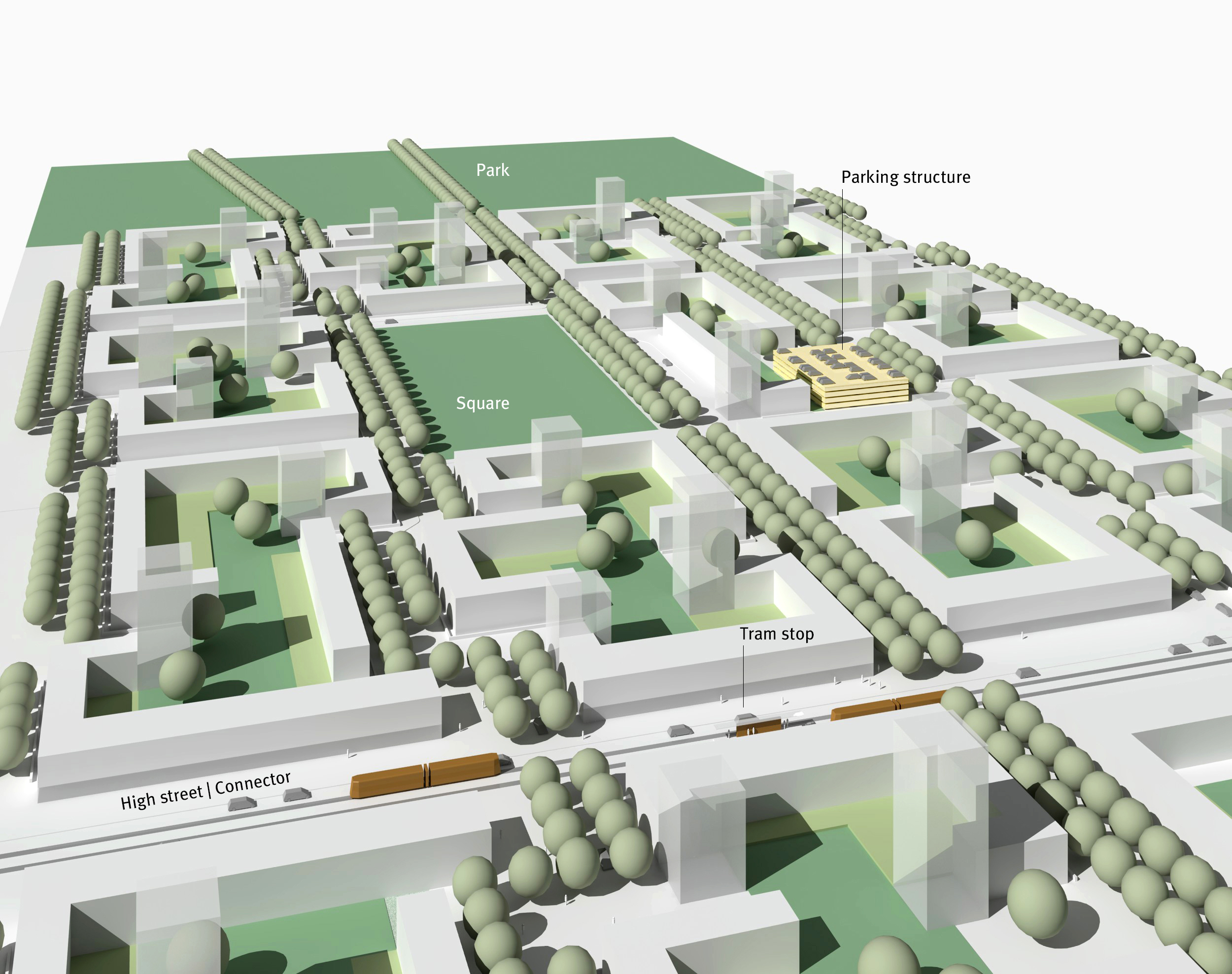
Similarly, the idealised green belt typology which I sketched out in the previous post (here) takes its place in an ‘urban village’; this time, a green belt village. Although by definition not a central district, it is not treated as suburban: it remains urban. It makes up a neighbourhood with a similar topology and scale to Northcote Road, Battersea. There is a ‘lazy’ grid topology with blocks with a slightly smaller perimeter (170 m x 95 m).
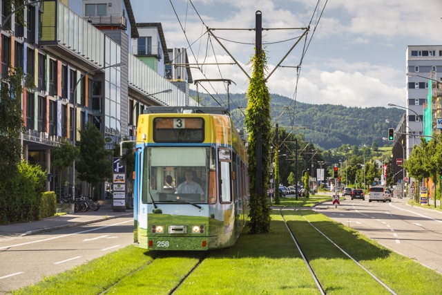
Trams are routed along the central connector, which generates enough footfall and ‘place’ to support commercial spaces. This street could take on the specific character of a street such as Northcote Road; however, other precedents are available. For instance, shown below is a view of a main road in the Vauban district of Freiburg:
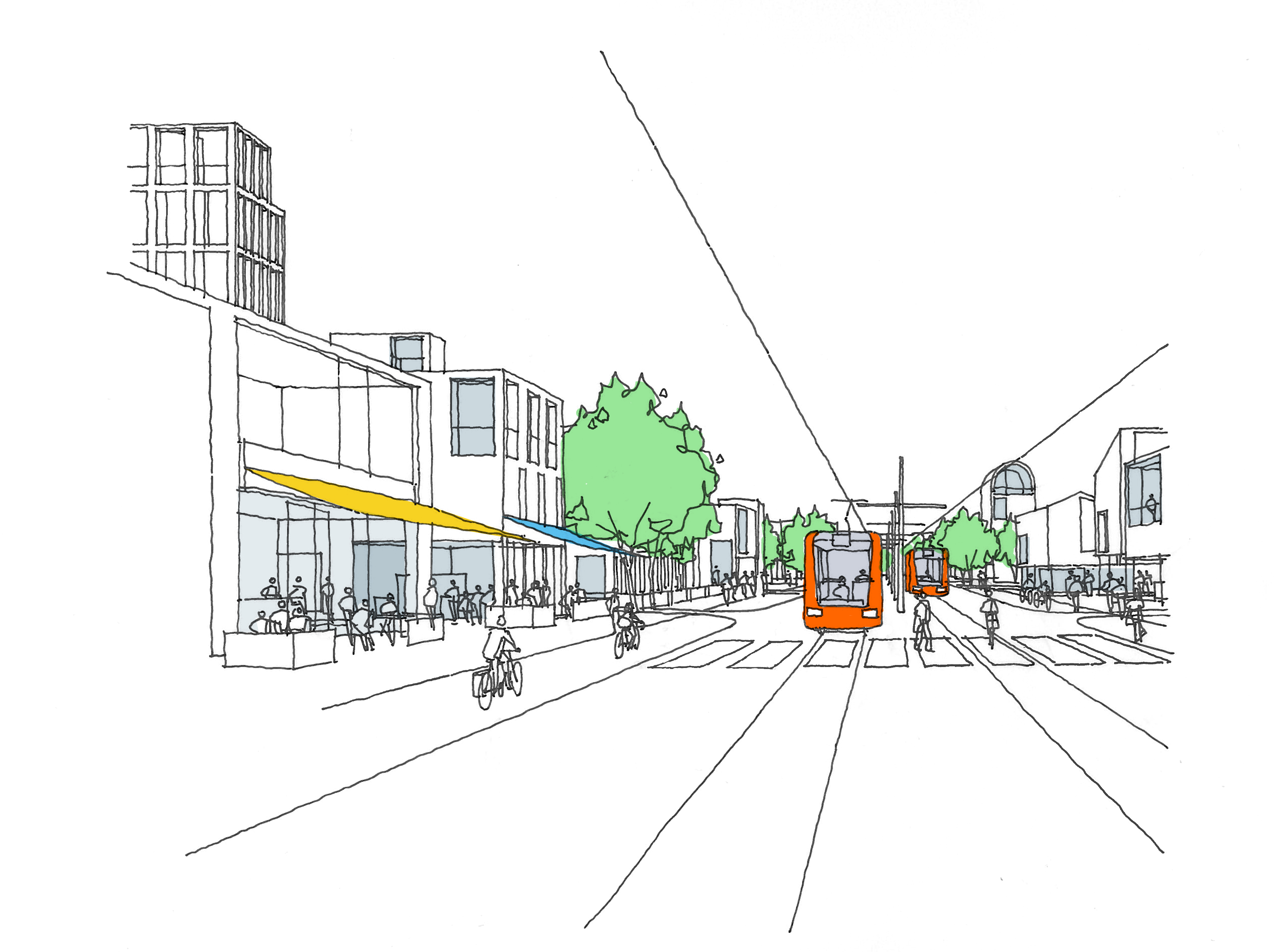
The character of the high street in my ideal model neighbourhood is probably closer to Vauban than Battersea. As the sketch below shows it is wider, at 36 m, and contains pavement seating, pavement, segregated cycle lanes (on both sides of the street), and a roadway for light vehicular traffic and trams. (Trees from the intersecting local roads are visible, but the high street is not planted as an avenue as this is bad for commerce.)
What really matters here is the basic hierarchy of connector to grid to green space. If everything of value in the neighbourhood is to be walkable, there must be quick access to not only amenities such as high street shops but also to transportation for non-local journeys. The planning principle followed in the model is to keep foot journeys to under 800 m at a maximum. Below is the furthest possible foot journey form dwelling to tram stop, at 630 m:
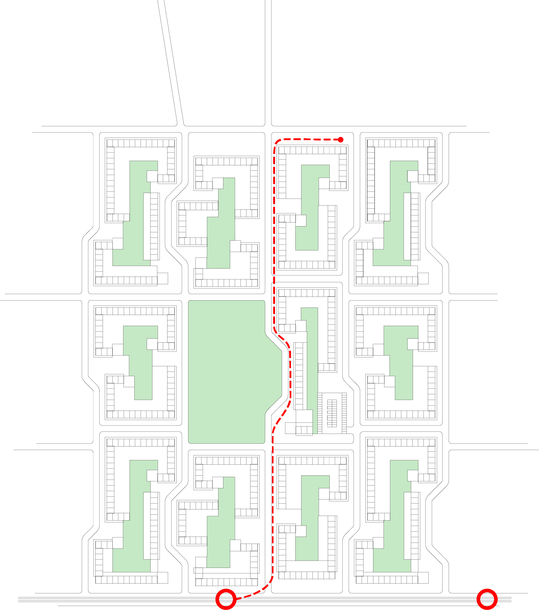
The reverse of this journey represents the furthest distance from dwelling to park. The model is also car-free, with exceptions made for pick-up and deliveries: this means that the streets can be driven but the only parking provided is in a neighbourhood multi-storey parking structure. Again, this is easily reached on foot; the route shown below is 500 m:

In the next (and probably final) post in this series, I’ll look at the sorts of planning principles that can bring additional variety and character to a new neighbourhood that is set out functionally along the lines described here.

One thought on “Building in the green belt: 3”