The urban ‘dog leg’ is an under-used arrangement, I reckon. Here’s a nice one in Durand Gardens, Stockwell: note the house wedged into the angle.

It’s a delight to walk around this corner: there is some rat running but the acute change in direction does seem to deter drivers. And the people at Space Syntax insist that their urban planning ‘rules’ can be OK with the occasional dog leg, even though they restrict sightlines. My ideal design for green belt (or, I suppose, suburban) housing (see these earlier posts) also features dog legs:
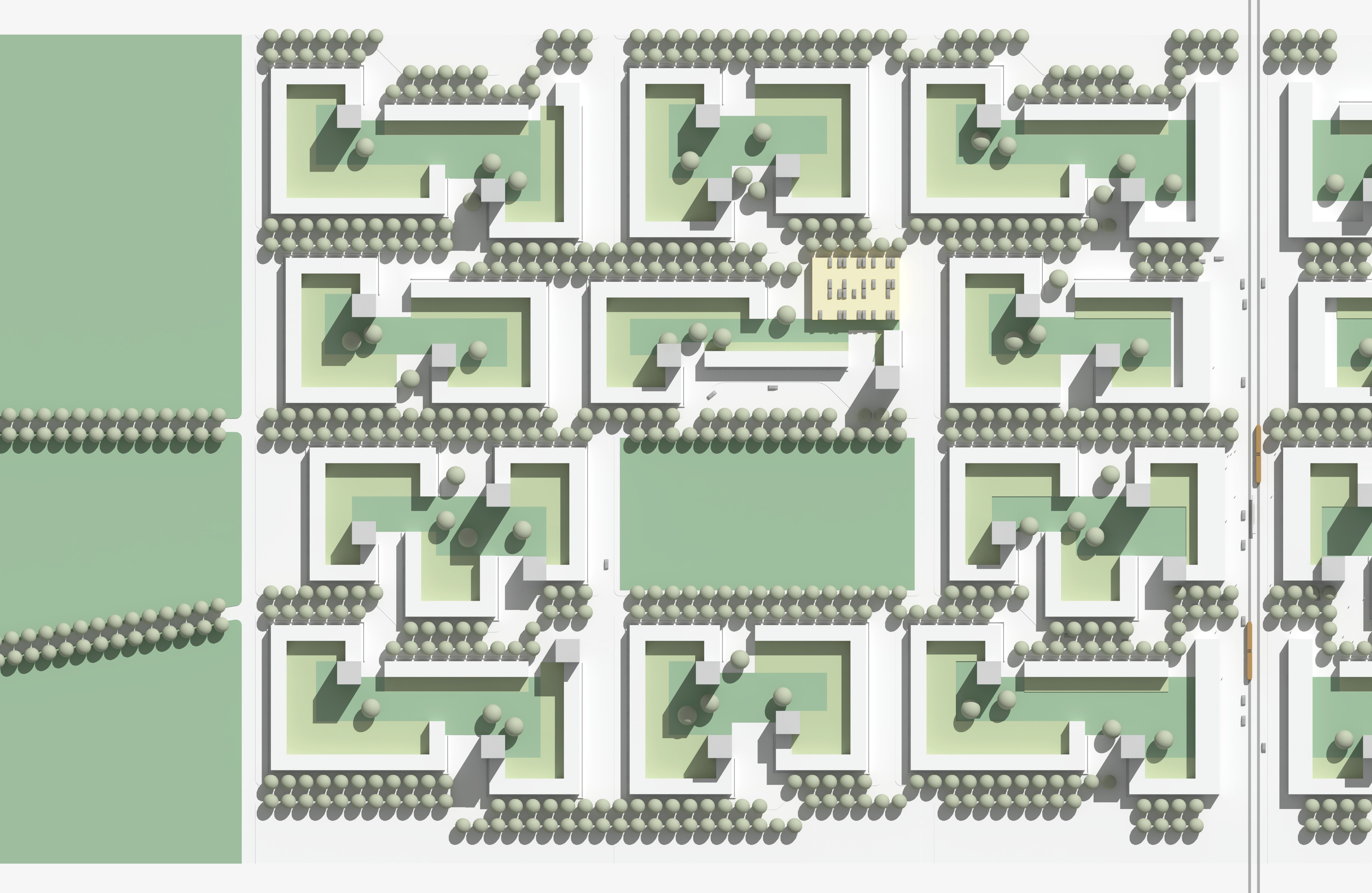
This is deliberate: it’s a way of making a ‘lazy grid’. This in turn supports a subtle hierarchy of streets, where straighter roads are (slightly) higher in the hierarchy than more meandering routes. (Tree planting (or absence of), street width and presence of public transport route also factor into the hierarchy.) The dog leg inflection is good for siting an entrance, typically in this design to the lobby of a ‘multi-family’ building where a degree of footfall can be expected. Below is a sketch of one of these conditions.

This dog leg isn’t deep enough to completely block through visibility, and everything is well surveilled: there are no blank ‘end of terrace’ frontages, as deprecated in e.g. Secured by Design. The geometry here is all orthogonal and may seem quite rigid (then again, look at Mayfair’s estates) but this is an ideal design and it’s assumed that a real site, with real topography, existing streets to connect to, extend, etc., would cause things to move around a bit.
